
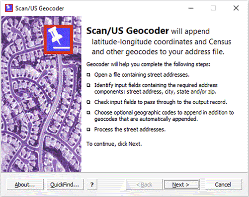
Scan/US Desktop Geocoder
Do you need a desktop Geocoder?
When you have a large number of addresses to which you must assign geographic coordinates, a fast desktop batch geocoder is a necessity.
If the locations file you want to map already has latitude and longitude for each record, you do not need a geocoder.
When you have only a few addresses, you can use the “Find Address”, “Site Express”, or “Go To...” menus that are built in to every Scan/US demographic subscription.
If you have a lot of addresses, but feel you cannot afford in-house geocoding with the Scan/US Desktop Geocoder, you should consider Scan/US Geocoding Services.
What is Geocoding?
Geocoding is the process of converting geographic information into latitude/longitude coordinate pairs. For example, 123 Main Street, in Anytown, USA, is geographic information. But that information must be transformed into numeric values (Latitude/Longitude coordinates) before the address can be rendered on a map.
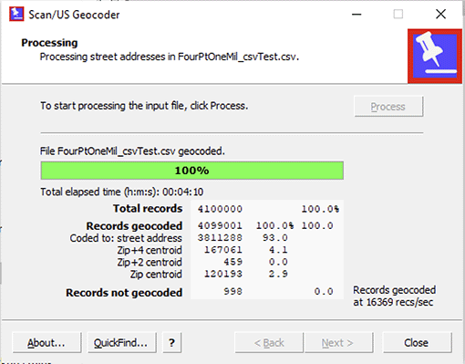
Geocoding parses the address components, then matches them to a database of coordinate information. These coordinates are added to the address record, and written to an output file. Then, mapping software can read the geocoded file and display all the locations.
 Address Standardization.
Scan/US Geocoder will process your file, standardizing addresses to U.S. postal regulations, and assign Latitude and Longitude coordinates and geographic IDs, all in a single pass.
File size limit: the standard geocoder license limits you to a maximum input file size of 200 MB. A premium geocoder license allows unlimited file sizes.
Scan/US Geocoder assigns coordinates with precision, based on the exact street address or a ZIP+4 centroid—precise enough to show your locations on the correct side of the street.
Geocoding Accuracy
Why is Scan/US Geocoder the most accurate? Scan/US Geocoder references both the latest U.S. Census Bureau’s TIGER street database and a 55 million record ZIP+4 database to look up your addresses and assign coordinates to them. When a matching address is found in the TIGER street database, its Lat/Long coordinate is assigned to your address. When a match is not found, Scan/US Geocoder assigns a coordinate from the ZIP+4 database, or as a last resort, a 5-digit ZIP centroid.
You get the best match rates from Scan/US Geocoder because the addresses in its street database have been standardized to U.S. Postal Service’s guidelines. During processing, your addresses are also standardized to those same guidelines—minimizing the effect of incorrect or incomplete addresses and misspellings—to ensure that the best matching addresses are found in the reference databases.
© 1992-2024 - Scan/US, Inc.