
Scan/US Coordinate PointCoder
Do you have latitude/longitude coordinates and need information about those neighborhoods?
Locations-to-area translation
When you have a lot of geographic coordinates, and need population characteristics for where they are, use the Scan/US PointCoder.
- You have: Latitude Longitude coordinates
- You want: Population characteristics for those locations
- You need: The Scan/US PointCoder
What does the PointCoder do?
Pointcoding converts latitude/longitude coordinates into the tiny Scan/US Microgrid(™) neighborhood area where the coordinate is.
A grid summary file is also produced. It shows a count of the number of coordinates inside each small Scan/US Microgrid(™) area. This file can be made into an informative map in Scan/US, showing customer concentrations AND at the same time population characteristics in the given area, for any collections of coordinates you process.
What you have
You have a large file of latitude-longitude coordinates, perhaps representing cell phone location coordinates or rideshare (scooters or bikes, for example)latitude longitude drop-off or summary points.
Scan/US PointCoder will process your file FAST (with an unlimited
number of locations anywhere in the U.S.)
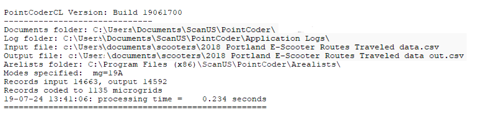
Scan/US PointCoder assigns coordinates with precision, showing the exact Scan/US Microgrid(™) in which each point falls. And you get a separate summary file you can load directly into Scan/US for informative mapping.
Point Coding Accuracy
The Point coder is as accurate as the Latitude/Longitude coordinates you supply. When a grid match is not found, Scan/US PointCoder does not assign a grid, and writes the record into an exceptions file, so you can see how many coordinates fall outside a residential area
(Note: when assigning to ZIP, Block Group, or Census Block, the PointCoder will produce fewer exceptions, since these cartographies provide continuous coverage. Only Scan/US Microgrid(™)s will given an indication you may be outside a residential area)
You get real response rates from Scan/US PointCoder because the Scan/US Microgrid(™)s are updated every year. What if you need a cross-reference to ZIP, County, Census Tract or Census Block Group or even MSA? Scan/US Pointcoder can give you that too.
Is it a Geocoder?
The Scan/US PointCoder does attach codes, but unlike conventional geocoders, it does not require an address: Just latitude/longitude coordinates anywhere in the U.S.
If your file ONLY has street addresses, and NOT latitude/longitude coordinates, then you need the Scan/US Desktop Geocoder.
What can I do with the PointCoder?
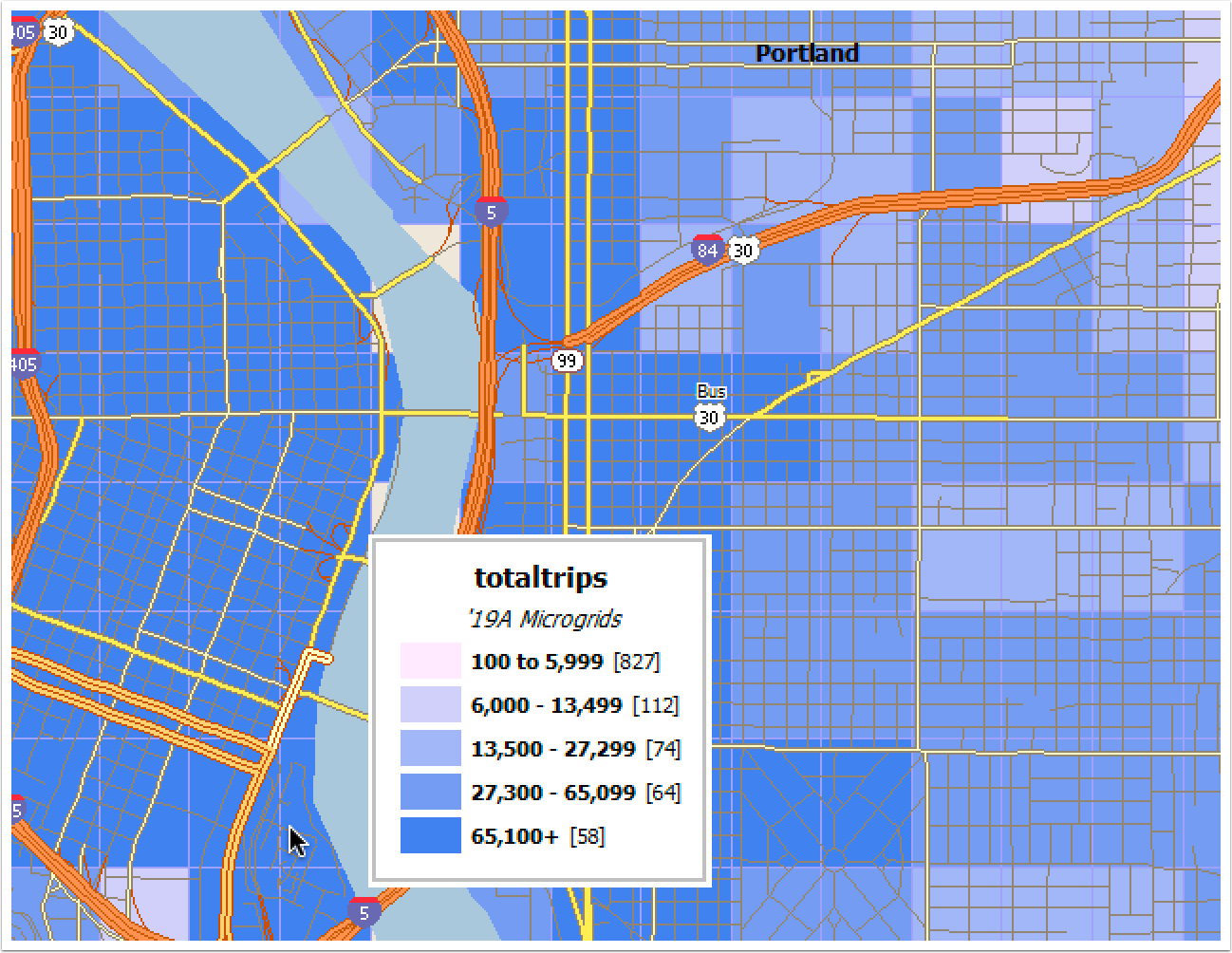
A map showing a collection of point coordinates may have a uniform, un-informative appearance.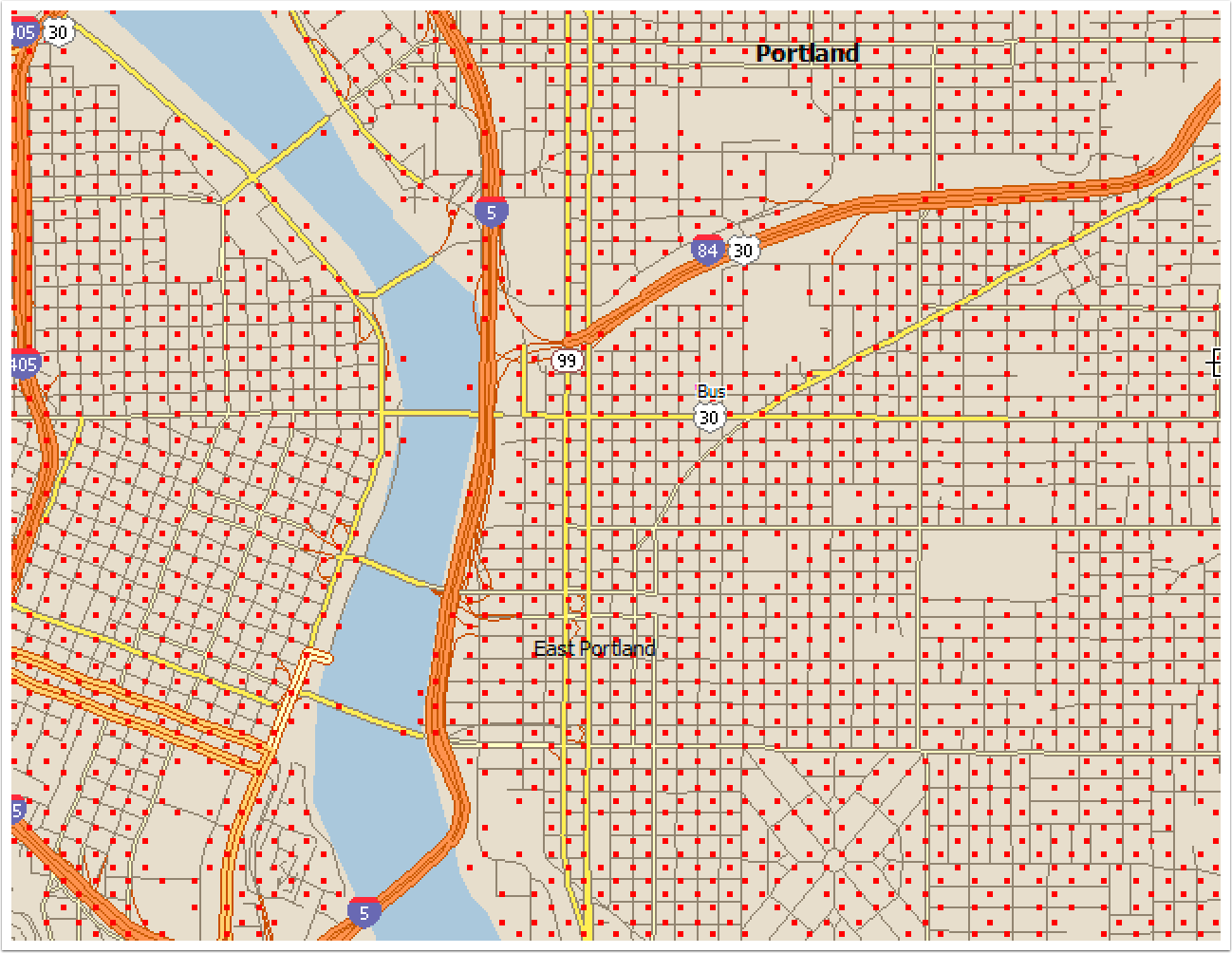 Get the grids that the rides fall into, and then look at the distribution of the aggregate rides. The map looks more informative
 Who lives there?
Let's take a moment to do a report only for the 58 high-traffic grids (dark blue)
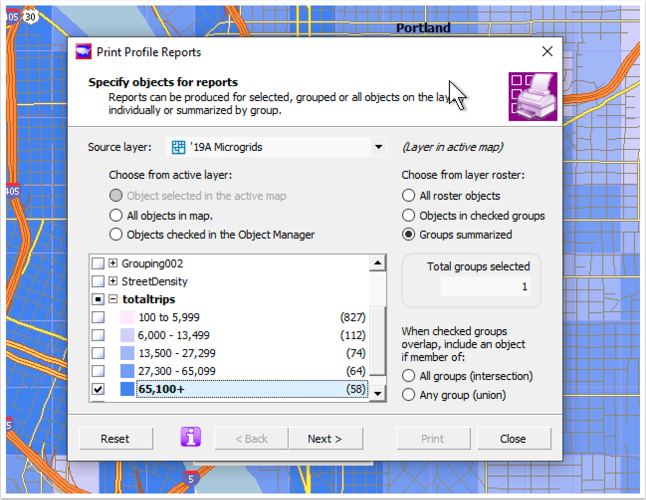
When we pick a report, we can also pick columns for the surrounding area, the city of Portland and the entire MSA
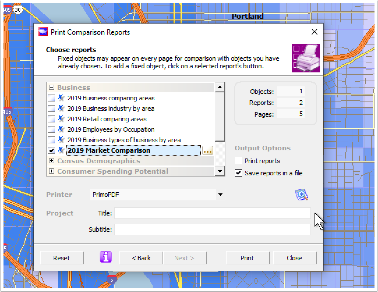 Click on the image below to see the report in more detail
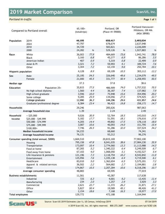
Tools required for the full example on this page:
- Scan/US Coordinate PointCoder (Grid coding)
- Scan/US Daytime Premium Subscription (Market Comparison report)
The Scan/US PointCoder, a Windows command line tool, requires Microsoft Windows.
© 1992-2024 - Scan/US, Inc.